The US Geological Survey National Geologic Mapping Program’s New Jersey Surficial Geology of the Orange Quadrangle, in Essex, Passaic Hudson and Bergen Counties describes the geology of Montclair.
9 Graham Terrace is circled on the map below:
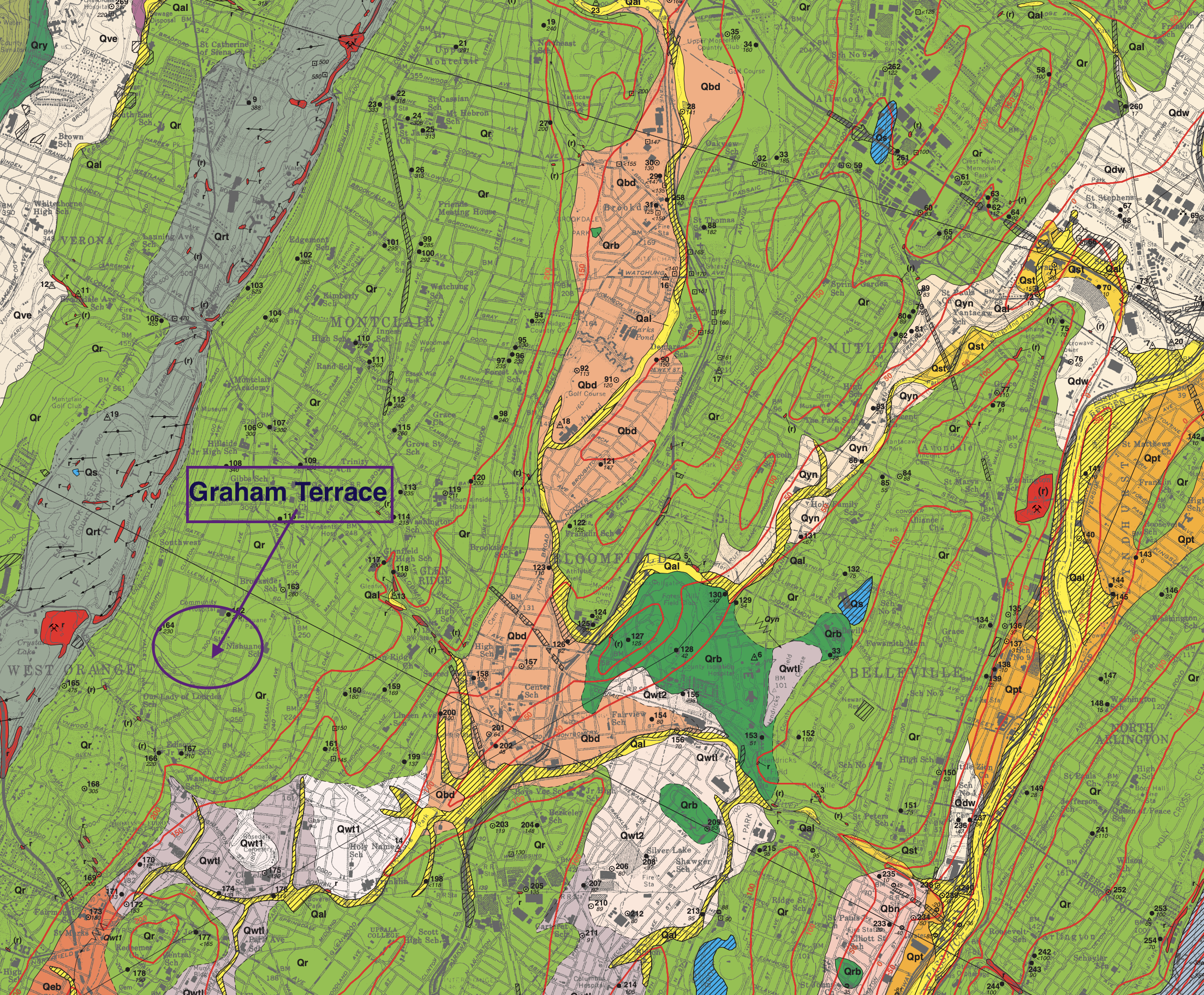
As the map indicates, the geological category is Rahway Till.
Till and Related Deposits–Poorly-sorted, nonstratified sediment deposited directly by glacial ice or by sediment flows from glacial ice. RAHWAY TILL–Reddish-brown to light-reddish-brown silty sand to sandy clayey silt containing some to many subrounded and subangular pebbles and cobbles and few subrounded boulders. Generally compact below the soil zone. May show a coarse subhorizontal fissile structure. Gravel clasts include chiefly red sandstone and siltstone, some gray sandstone and mudstone, and minor white-to-yellow quartz, gray-to-purple quartzite-conglomerate and gray gneiss. Dark-gray basalt is common on and west of First Mountain. Boulders are chiefly gneiss and gray quartzite; basalt boulders are common on and west of First Mountain. As much as 60 feet thick. Unit Qrt delineates areas where Qr is discontinuous and generally less than 10 feet thick. Contacts with unit Qry are gradational and Qry may underlie Qr in places on and west of First Mountain.